Hidden Falls lies about 5½ miles along the Tarbell Trail, starting from the northern-most trailhead, which sits by an isolated parking lot. If it’s a busy day there may be one or two other cars sitting along the Washington DNR’s signature-style pit toilet. Other than that your interactions with others might be limited to the sight of a logging company’s trucks passing through in the summer.
The Path to Hidden Falls
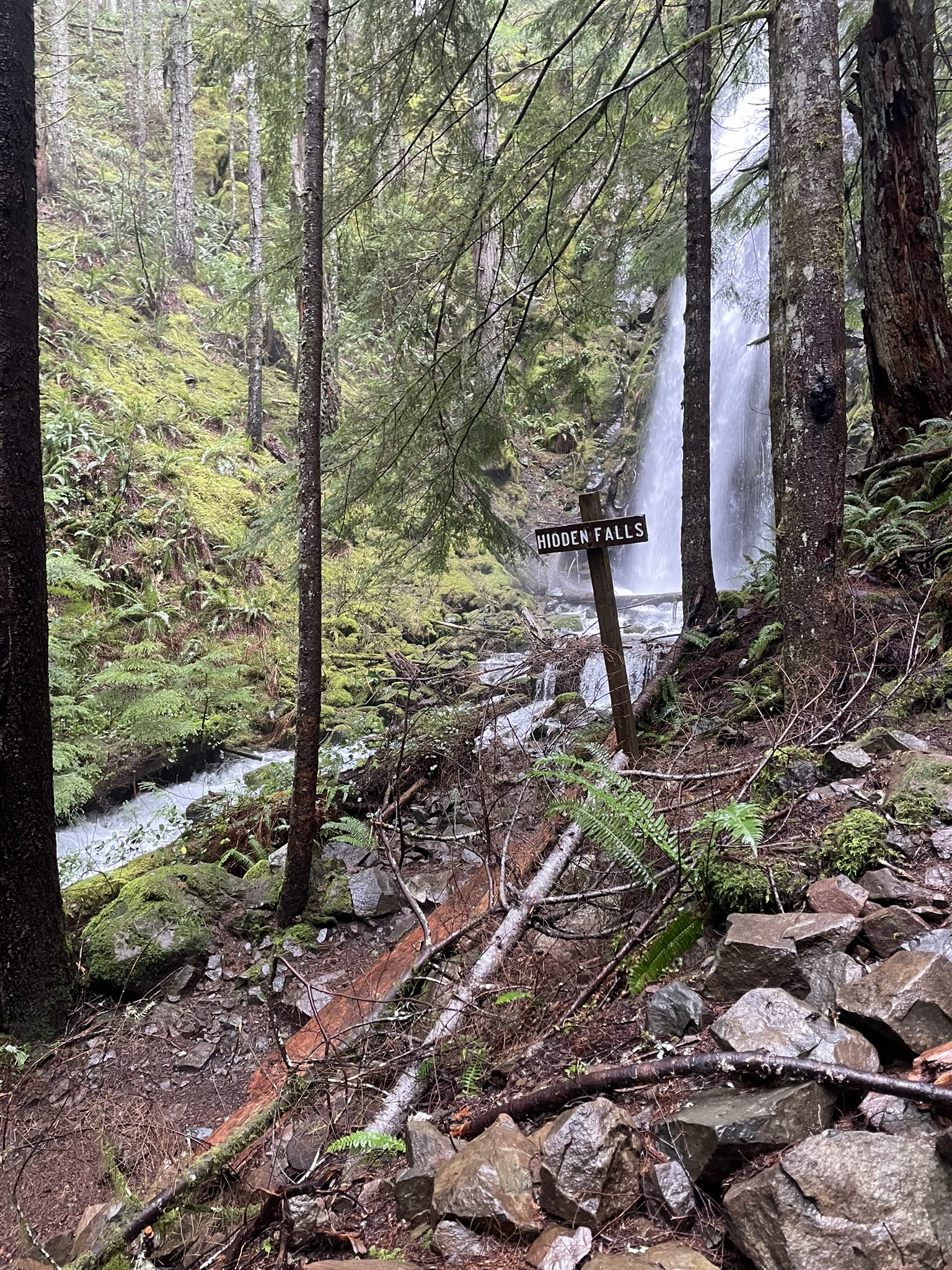
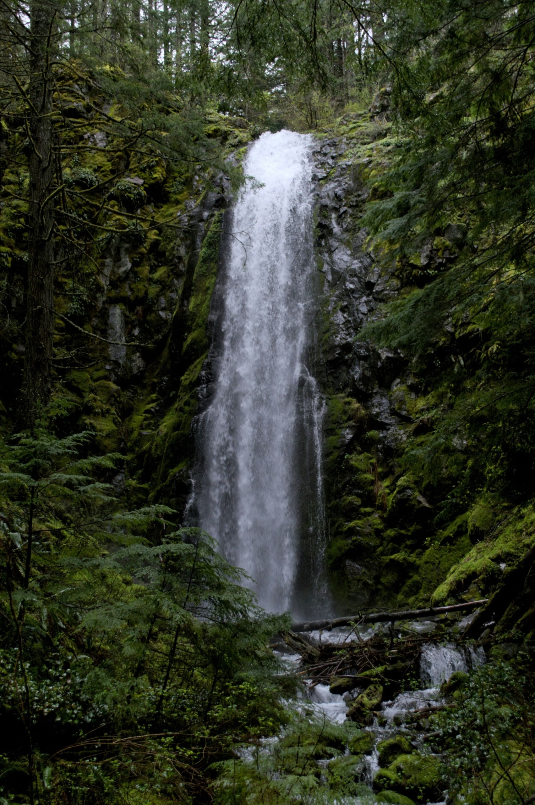
After you take the short access trail from the parking lot onto to the trail you’ll be guided deep into the Yacolt Burn State Forest. Nearly all of the hike’s vertical climb is in the first two or so miles, on the way to the peak of Kloochman Butte. Soon enough though, you’ll be riding on the edge of the Yacolt Forest while heading down into a small valley that safeguards the falls. You’re first few sights of water will be a mile or so out, but soon enough you’ll wrap around to the sight that made the entire hike worth it.
The hike to Hidden Falls is usually around 11 miles round trip, with moderate elevation gain (which is inconsistent to say the least). There is also very limited cellular connectivity in most of the Yacolt Burn State Forest, especially this far in, that said GPS coverage is pretty good, even in the thicker coverings of the forest. All of this is to say that Hidden Falls might not be the best hike for beginners, if you are in or around Clark County there are plenty of amazing hikes in the area (maybe check out Bell’s Mountain Trail if you’re looking for an easier hike.)
The falls themselves are certainly hidden, I have hiked this exact path with friends and family about four times as well as an entire full-length backpacking trip of the entire Tarbell Trail, and I’ve only seen a total of two or three other people in this exact spot across all of those trips. Most of these people seem to drive up to it through L-1182 on Jeeps, so you likely will not find anyone else on the trail.
Getting To The Trailhead
From Moulton Falls Regional Park head to NE Sunset Falls Road, then take a right onto NE Dole Valley Road, finally, take a left onto L-1100 Road the trailhead parking lot will be to the left of you. Make sure to watch out for aggressive drivers and be safe driving, a lot of drivers take the turns too fast and there are some pretty narrow roads.
Map Data
Feel free to also download the data (GPX) from this map for your GPS unit. I compiled it using GIS information from Clark County’s Open Data program.
Leave a Reply